Hind Aerospace provides advanced drone survey services across Kerala, delivering accurate geospatial data and reliable mapping solutions for government and private sector projects. Our UAV-based approach improves project speed and reduces reliance on conventional surveying techniques, making operations more efficient and cost-effective.
Using modern drone systems integrated with GIS technology, we generate high-quality aerial datasets that are processed into detailed maps, 3D terrain models, and analytical reports. These outputs support better planning, monitoring, and execution across various industries.
Our services are widely used in sectors such as infrastructure development, mining, agriculture, land management, and construction monitoring, ensuring precise and actionable insights for every project.
Focused on accuracy, compliance, and operational efficiency, Hind Aerospace continues to support Kerala’s rapid development with dependable and technology-driven drone solutions.
UAV Drone Survey and Aerial Mapping Solutions across Kerala, delivering high-resolution mapping, LiDAR surveying, photogrammetry, and inspection services.
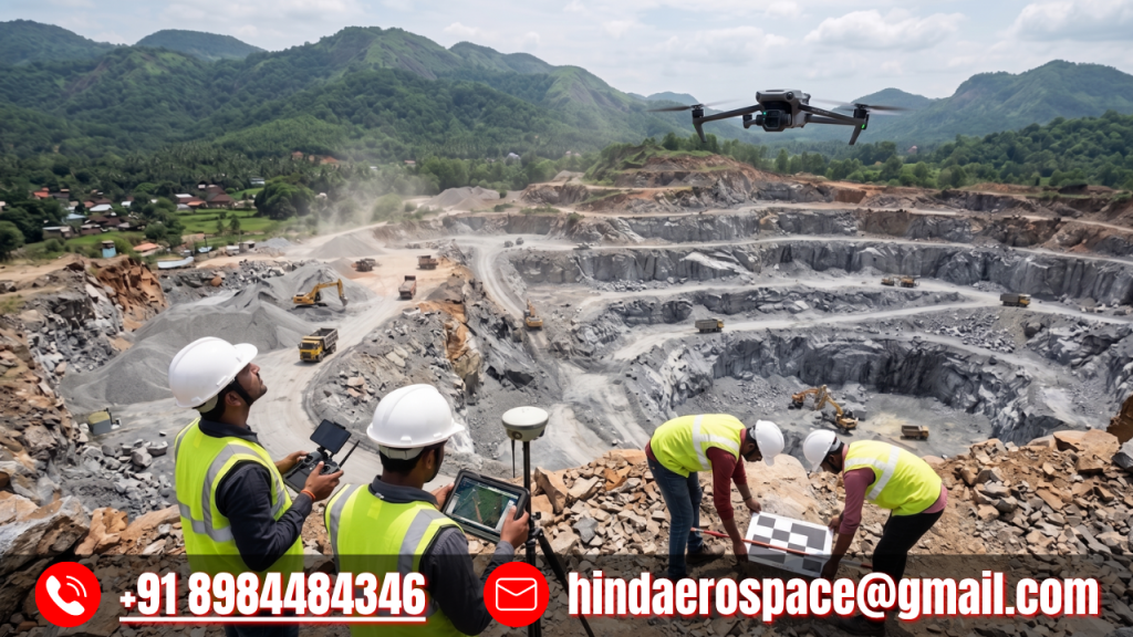
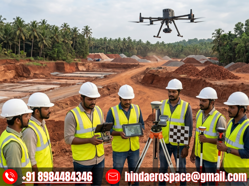
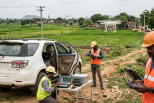
At Hind Aerospace, we provide cutting-edge UAV drone survey and aerial mapping solutions across Kerala, helping industries gain access to accurate geospatial intelligence for smarter project execution. By combining advanced drone platforms with modern surveying methodologies, we enable businesses to collect reliable aerial data that enhances planning, improves monitoring, and accelerates decision-making.
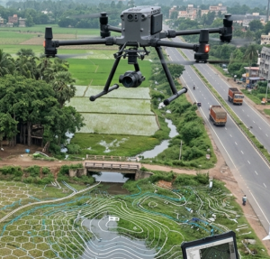
Our expertise covers high-resolution photogrammetry, LiDAR-based surveying, and multispectral imaging, delivering precise terrain data and detailed surface analysis even in challenging environments. These solutions support a wide range of applications, from infrastructure development and mining operations to agricultural monitoring and environmental assessment.
Beyond surveying, we offer aerial inspection services, professional drone videography, and complete drone data processing, transforming raw aerial captures into actionable deliverables such as orthomosaic maps, 3D models, and GIS-ready datasets. These outputs help organizations streamline operations and improve project accuracy.
We also specialize in solar PV drone inspections, enabling efficient fault detection, performance evaluation, and preventive maintenance planning for solar energy assets.
Driven by innovation, operational safety, and precision-focused workflows, Hind Aerospace delivers dependable drone-powered solutions for industries such as infrastructure, construction, energy, mining, and agriculture throughout Kerala, empowering clients with data-driven insights for better results.
Drone Survey & Mapping Team in Kerala
Hind Aerospace brings advanced drone survey and mapping services across Kerala, enabling industries to access precise aerial data for smarter planning and improved project execution. With the support of modern UAV technology, we help businesses collect dependable geospatial information for surveying, inspection, and monitoring applications.
Our skilled field team combines technical expertise with efficient on-site operations to capture high-quality aerial data across challenging environments. This allows project teams to gain better visibility, improve workflow efficiency, and make faster, data-driven decisions in sectors such as infrastructure, construction, agriculture, and land development.
At Hind Aerospace, we are committed to delivering accurate results through safe and efficient drone operations. By turning complex terrain data into practical insights, we help organizations across Kerala enhance productivity, reduce delays, and achieve greater operational success.
Drone Survey & Inspection Solutions in Kerala
At Hind Aerospace, we offer professional drone survey and inspection solutions across Kerala, helping businesses and project teams obtain accurate aerial insights for efficient planning and execution. Using advanced UAV systems, we capture reliable geospatial data that supports better monitoring, analysis, and decision-making across a variety of sectors.
Our experienced field team manages every stage of the drone operation with precision, ensuring smooth site execution and high-quality aerial data capture. The collected information is processed into practical insights that help improve workflow visibility, track project progress, and increase overall operational efficiency.
With a focus on accuracy, safety, and dependable performance, Hind Aerospace delivers trusted drone-based services for industries such as infrastructure, agriculture, construction, and industrial development throughout Kerala, helping clients achieve faster and more effective project outcomes.