At Hind Aerospace, we provide reliable and high-accuracy drone survey services across Andhra Pradesh, supporting businesses and government projects with precise mapping and data analysis. Our UAV-based solutions deliver faster, cost-effective results compared to traditional methods.
Using advanced drones and GIS technology, we capture detailed aerial data and convert it into accurate maps, 3D models, and actionable insights. Our services cover land surveying, mining, infrastructure, agriculture, and construction monitoring.
With a strong focus on quality, efficiency, and compliance, Hind Aerospace is committed to powering Andhra Pradesh’s development with modern drone solutions.
UAV Drone Survey & Aerial Mapping Services in Andhra Pradesh, offering advanced solutions such as aerial videography, photogrammetry-based mapping, LiDAR drone mapping, multispectral analysis, drone data processing, aerial inspections, and solar PV system inspection services.
Our UAV drone survey and aerial mapping services in Andhra Pradesh are designed to deliver high-precision, reliable, and efficient geospatial solutions for diverse industries. At Hind Aerospace, we integrate advanced drone technology with modern surveying techniques to generate accurate data that supports effective planning, monitoring, and decision-making.
From high-detail photogrammetry mapping for terrain modeling to LiDAR-based surveys for precise elevation data capture, we ensure exceptional accuracy even in complex environments. We also provide multispectral imaging solutions for agriculture and environmental assessment, helping clients monitor crop health and improve productivity.
Our expertise further includes aerial videography, infrastructure inspection, and advanced drone data processing, converting raw aerial inputs into orthomosaics, 3D models, and GIS-ready datasets. In addition, our solar PV inspection services help detect defects, enhance performance, and support preventive maintenance of solar installations.
With a strong focus on innovation, safety, and quality, Hind Aerospace delivers complete end-to-end drone solutions for infrastructure, mining, energy, and agriculture sectors across Andhra Pradesh.
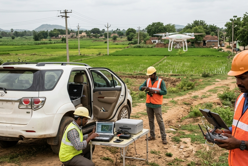
Our Professional Drone Survey & Mapping Team in Andhra Pradesh
Our Professional Drone Survey & Mapping Team in Andhra Pradesh at Hind Aerospace provides advanced UAV-based solutions for accurate and efficient data collection. We deliver reliable drone surveying, mapping, and aerial inspection services tailored for industries such as infrastructure, agriculture, construction, and land development. Our skilled team ensures smooth on-site operations while capturing high-quality geospatial data that supports better planning and faster decision-making. By combining precision, safety, and modern technology, we turn complex landscapes into clear, actionable insights. Hind Aerospace is dedicated to helping clients achieve efficient project execution and improved resource management across Andhra Pradesh.
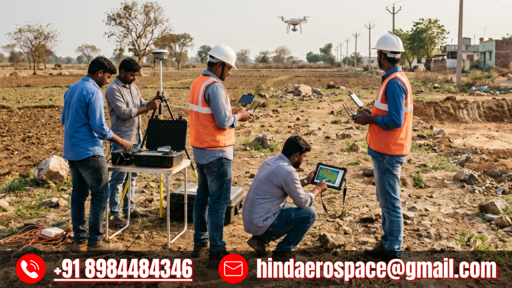
Professional Drone Survey & Inspection Solutions in Andhra Pradesh
Hind Aerospace offers reliable and high-accuracy drone survey and inspection services across Andhra Pradesh. Our team uses advanced UAV technology to capture precise aerial data for infrastructure, construction, agriculture, and industrial projects. We ensure efficient field operations, clear insights, and faster project execution. With a strong focus on quality, safety, and performance, Hind Aerospace delivers dependable results that support better planning and smarter decision-making.