Hind Aerospace provides professional drone survey and aerial mapping services across West Bengal, delivering accurate and efficient data solutions for both businesses and government projects. Our drone-based approach helps complete surveys faster while reducing overall costs compared to traditional methods.
With the use of advanced UAV systems and modern GIS technology, we collect high-resolution aerial data and convert it into detailed maps, 3D models, and valuable insights. Our services support a wide range of sectors including land surveying, mining, infrastructure development, agriculture, and construction monitoring.
Our experienced team ensures smooth on-site operations, precise data collection, and reliable project delivery. With a strong commitment to quality, safety, and innovation, Hind Aerospace continues to support development projects across West Bengal with modern and dependable drone solutions.
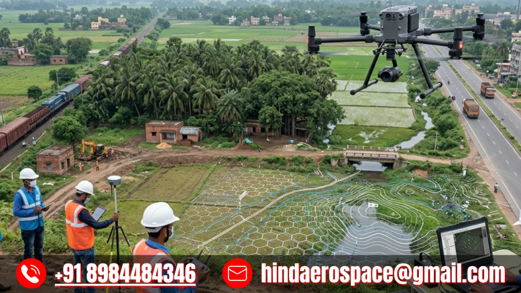
Advanced Drone Survey & Mapping Services in West Bengal
Advanced Drone Survey & Mapping Services in West Bengal are redefining how projects are planned and executed with speed, accuracy, and efficiency. At Hind Aerospace, we provide reliable UAV-based solutions that deliver precise aerial data for a wide range of industries.
Using modern drone technology combined with advanced GIS processing, we capture high-resolution data and transform it into detailed maps, 3D models, and actionable insights. Our services support sectors such as engineering, construction, mining, agriculture, and infrastructure development, helping clients make informed decisions with confidence.
Our experienced team ensures smooth on-site operations, accurate data collection, and timely project delivery. By reducing manual effort and improving overall efficiency, our drone survey solutions offer a cost-effective alternative to traditional surveying methods.
With a strong commitment to quality, safety, and innovation, Hind Aerospace continues to provide dependable drone survey and mapping services across West Bengal.
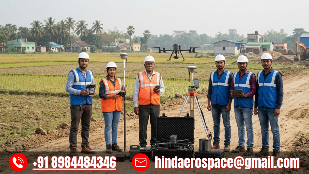
Our Professional Drone Survey & Mapping Team in West Bengal
Our Professional Drone Survey & Mapping Team in West Bengal at Hind Aerospace delivers advanced aerial solutions using cutting-edge UAV technology for precise and efficient data collection. We specialize in high-accuracy drone surveying, mapping, and aerial inspection services across industries such as infrastructure, agriculture, construction, and land development. Our expert team ensures reliable field operations and generates detailed geospatial data to support smarter planning and decision-making. With a strong focus on accuracy, safety, and efficiency, we transform complex terrains into actionable insights. Hind Aerospace is committed to providing professional drone services that enable faster project execution and better resource management across West Bengal.
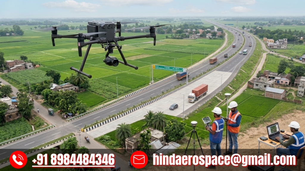
Reliable Drone-Based Survey & Inspection Services in West Bengal
Hind Aerospace delivers advanced drone-based survey, mapping, and inspection services with high accuracy and efficiency. We provide aerial surveying, 3D modeling, photogrammetry, and GIS data processing for infrastructure, construction, and land development projects. Our drone inspections ensure safe monitoring of industrial assets, while our agriculture services support crop analysis and field mapping. Using modern UAV technology, we help clients make smarter decisions with precise data. Our solutions reduce time, cost, and risk, ensuring reliable and professional results across West Bengal.