At Hind Aerospace, we provide expert drone survey in Maharashtra, delivering accurate geospatial data and dependable UAV mapping solutions for government and private sector projects. Our advanced drone surveying in Maharashtra improves project efficiency, reduces execution time, and provides a modern, cost-effective alternative to traditional land surveying methods.
By integrating advanced UAV platforms with GIS technology, we capture high-resolution aerial data and transform it into precise maps, 3D terrain models, and analytical reports. This drone mapping in Maharashtra helps businesses improve planning accuracy, monitor project progress effectively, and optimize field operations.
Our UAV survey solutions in Maharashtra are widely used across sectors such as infrastructure development, agriculture, land management, mining, and construction monitoring, delivering reliable data and actionable insights at every stage of the project.
With a strong focus on precision, compliance, and operational excellence, Hind Aerospace supports industrial and infrastructure growth through trusted drone survey and mapping in Maharashtra, helping organizations complete projects faster and more efficiently.
UAV Drone Survey and Aerial Mapping Solutions in Maharashtra, delivering high-resolution drone mapping, LiDAR surveying, photogrammetry, and aerial inspection.
At Hind Aerospace, we provide advanced UAV drone survey and aerial mapping in Maharashtra, delivering precise geospatial intelligence that helps businesses improve planning, enhance efficiency, and execute projects with greater accuracy. Our drone mapping solutions in Maharashtra are designed to support industries with reliable aerial data, improved site visibility, and smarter operational decisions.
With expertise in LiDAR surveying, high-resolution photogrammetry, and multispectral drone imaging, we capture detailed terrain and surface data for a wide range of applications. From infrastructure development and land management to agriculture and environmental monitoring, our UAV survey in Maharashtra deliver the accurate insights needed for efficient project planning and execution.
We also provide aerial inspections, drone videography, and complete drone data processing, converting aerial imagery into valuable outputs such as orthomosaic maps, 3D terrain models, and GIS-ready datasets. These deliverables help businesses improve operational efficiency, reduce delays, and strengthen field coordination.
Our solar PV drone inspection in Maharashtra help the energy sector by enabling rapid fault detection, improved maintenance planning, and better system performance. With a strong focus on innovation and operational precision, Hind Aerospace delivers reliable drone survey and aerial mapping in Maharashtra, helping industries optimize resources, improve productivity, and achieve better project outcomes.
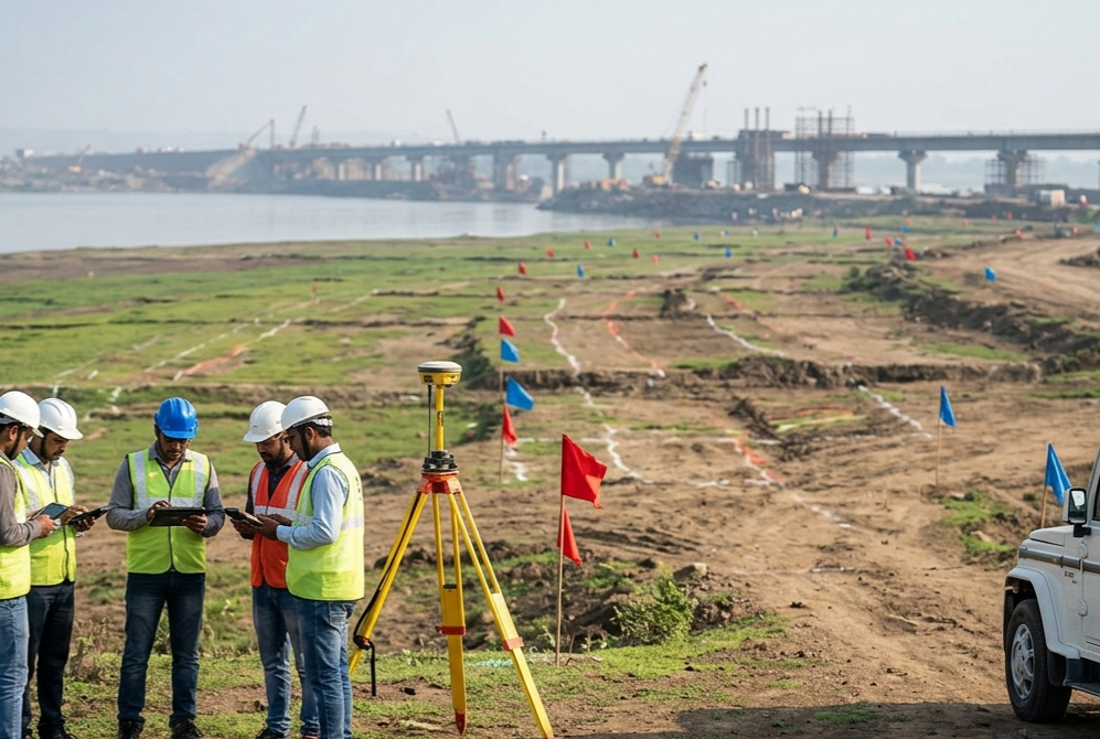
Drone Survey & Mapping Team in Maharashtra
Hind Aerospace offers trusted drone survey and mapping in Maharashtra, helping businesses collect accurate aerial data for better planning and faster project execution. Our UAV-based solutions are designed to deliver reliable geospatial information for land surveys, aerial inspections, mapping, and project monitoring across multiple industries.
With the support of modern drone technology and experienced field professionals, we capture high-resolution aerial data that improves project visibility and supports smarter on-site decisions. Our drone mapping in Maharashtra is widely used in construction, mining, infrastructure, agriculture, and land development projects where precision and efficiency are critical.
At Hind Aerospace, we focus on delivering accurate results through safe and efficient drone operations. Our UAV survey in Maharashtra helps organizations reduce manual effort, improve workflow efficiency, and complete projects with greater speed and confidence.
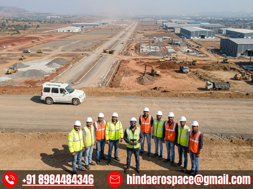
Advanced Drone Survey & Inspection Solutions in Maharashtra
Hind Aerospace offers trusted drone survey and mapping in Maharashtra, helping businesses collect accurate aerial data for better planning and faster project execution. Our UAV-based solutions are designed to deliver reliable geospatial information for land surveys, aerial inspections, mapping, and project monitoring across multiple industries.
With the support of modern drone technology and experienced field professionals, we capture high-resolution aerial data that improves project visibility and supports smarter on-site decisions. Our drone mapping in Maharashtra is widely used in construction, infrastructure development, agriculture, and land assessment where precision and efficiency are critical.
At Hind Aerospace, we focus on delivering accurate results through safe and efficient drone operations. Our UAV survey in Maharashtra helps organizations reduce manual effort, improve workflow efficiency, and complete projects with greater speed and confidence.