Aerial Survey Data Processing Solutions in Jharkhand
High-Accuracy Drone Image Processing for Mapping Projects
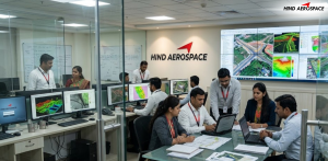
Hind Aerospace provides professional aerial survey data processing services in Jharkhand, helping industries convert drone-captured imagery into detailed geospatial outputs for planning, monitoring, and analysis. Our advanced processing workflow supports engineering, infrastructure, mining, and land development projects that require reliable spatial data with high precision.
Orthomosaic Mapping, Elevation Models & 3D Visualization
Our drone processing capabilities include orthomosaic map generation, 3D model creation, contour extraction, DEM, DTM, and DSM development for accurate terrain and surface analysis. These mapping solutions in Jharkhand are widely used for mine surveys, construction progress tracking, route planning, land assessment, and project visualization where detailed aerial intelligence is essential.
Hind Aerospace delivers advanced GIS data processing, LiDAR mapping, georeferenced image correction, thermal analysis, and multispectral data interpretation for complex survey requirements. By processing UAV-generated datasets into structured digital outputs, we help organizations across Jharkhand improve inspection accuracy, site analysis, and technical decision-making.
Reliable Drone Analytics for Industrial & Infrastructure Projects
Our drone imagery processing services are designed to support modern industrial operations with fast and dependable geospatial reporting. From volumetric calculations and land survey outputs to infrastructure inspection analytics and aerial documentation, Hind Aerospace ensures accurate drone data processing solutions tailored for large-scale projects across Jharkhand.