Precision Survey Data Enhancement & Aerial Intelligence Solutions in Haryana
Orthophoto Processing for Urban Infrastructure Mapping
Hind Aerospace provides orthophoto processing services in Haryana for urban infrastructure and development projects. Drone-captured aerial imagery is transformed into highly detailed mapping outputs that support project visualization, planning accuracy, and large-scale site assessment activities.
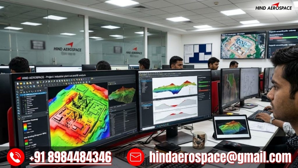
Drone Elevation Analysis for Industrial Construction Projects
Industrial construction projects require reliable terrain and elevation understanding for effective execution. Hind Aerospace processes aerial survey datasets into elevation-based outputs that help teams evaluate land conditions and improve construction planning workflows.
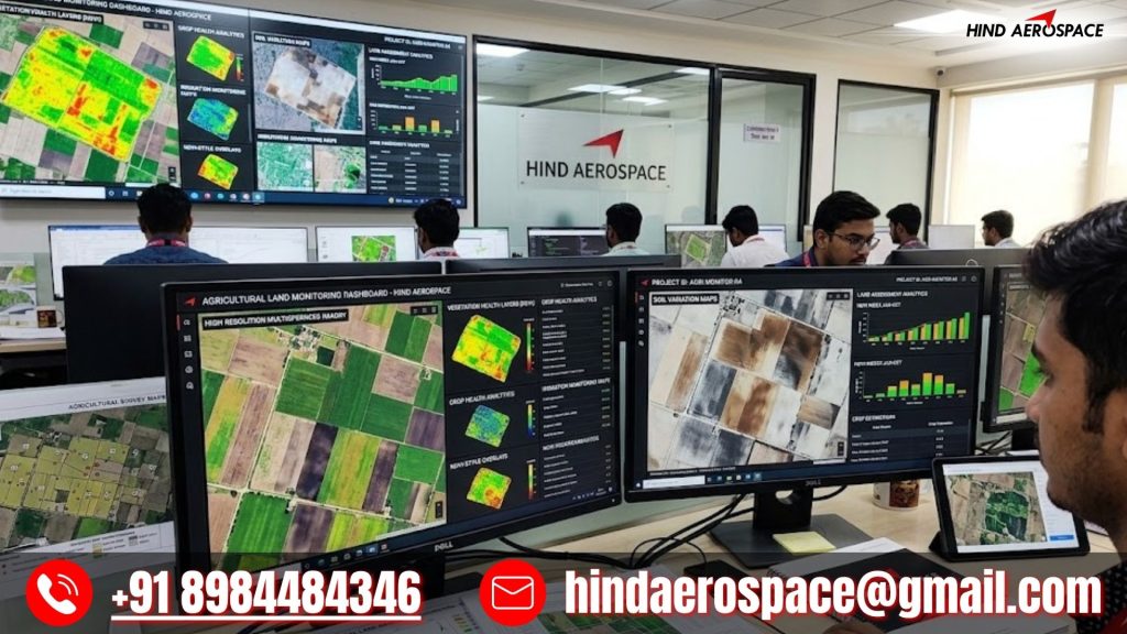
Remote Imaging Processing for Agricultural Land Monitoring
Haryana’s agricultural regions require accurate aerial insights for land observation and survey activities. Our remote imaging processing solutions convert UAV datasets into structured outputs that support land monitoring, survey interpretation, and field analysis requirements.
Spatial Dataset Processing for Logistics & Commercial Development
Large logistics parks and commercial expansion projects depend on accurate spatial intelligence for planning and execution. Hind Aerospace transforms raw drone survey information into processed geospatial outputs that support monitoring, site analysis, and informed project decisions.