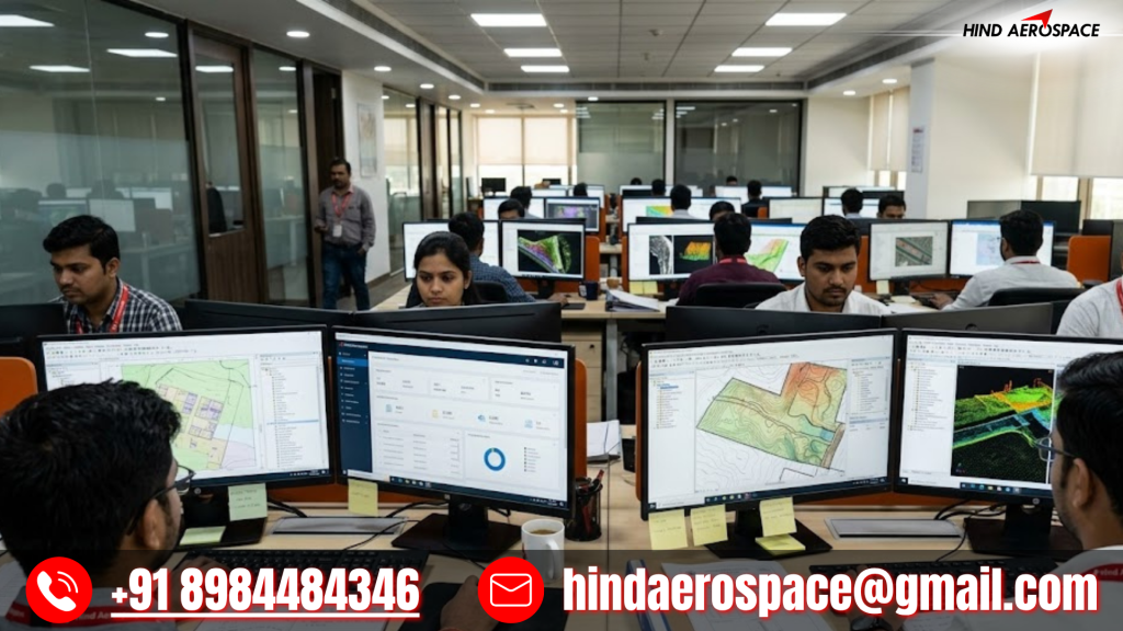
High-Accuracy UAV Data Processing for Manufacturing & Industrial Projects
Hind Aerospace provides high-accuracy UAV data processing services in Tamil Nadu, supporting manufacturing hubs and industrial development projects with reliable geospatial outputs. Our advanced processing workflow converts raw drone data into actionable insights that help organizations improve planning, monitoring, and operational efficiency.
Drone Mapping Solutions for Smart Infrastructure & Urban Development
Tamil Nadu continues to witness rapid growth in infrastructure and urban expansion projects that require detailed aerial intelligence. Hind Aerospace processes drone-captured imagery into mapping outputs that support road projects, smart infrastructure planning, land assessment, and development activities across the state.
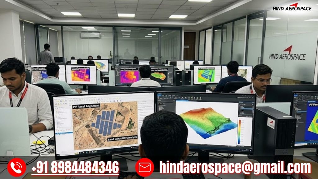
Advanced Geospatial Processing for Renewable Energy & Solar Projects
Tamil Nadu has a strong renewable energy sector with large-scale solar and wind energy developments. Our drone data processing services generate accurate terrain models, mapping datasets, and analytical outputs that support project planning, inspection workflows, and site analysis requirements.
Intelligent Survey Data Analytics for Engineering & Land Development Projects
Engineering and land development projects demand structured geospatial information for faster and more informed decisions. Hind Aerospace transforms UAV-generated datasets into practical analytical outputs that help project teams improve site visualization, survey interpretation, and overall project execution efficiency.