Drone Data Intelligence & UAV Geospatial Processing Services in Goa
Aerial Survey Data Conversion for Infrastructure & Environmental Projects
Hind Aerospace delivers advanced drone data intelligence solutions in Goa for organizations that require precise UAV survey outputs and structured geospatial datasets. Our aerial data processing systems convert raw drone captures into refined digital intelligence used for planning, development control, coastal monitoring, and engineering analysis with high operational accuracy.
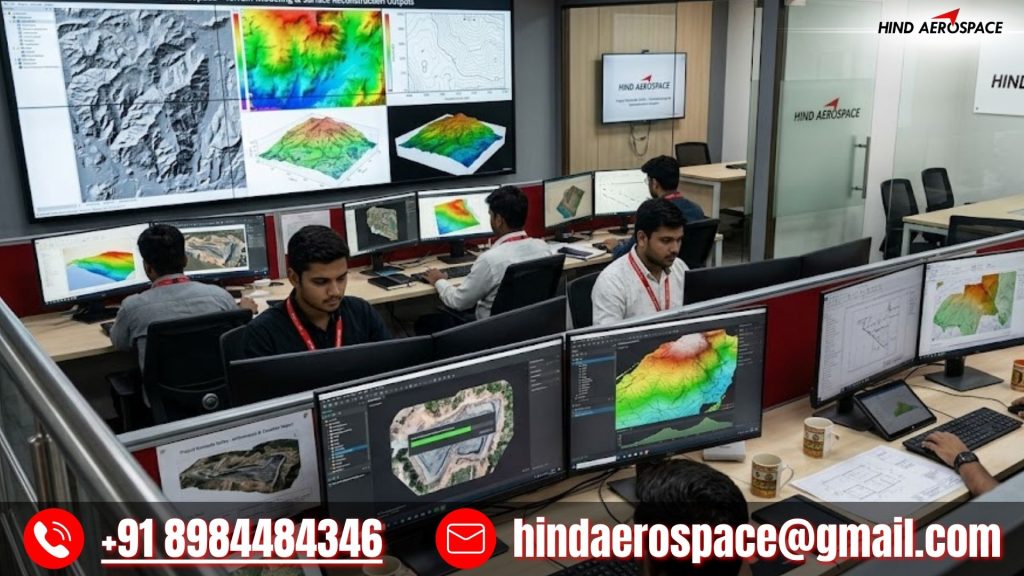
We provide detailed orthomosaic stitching, elevation modeling, DEM/DTM generation, DSM refinement, contour extraction, and 3D terrain reconstruction using high-resolution photogrammetry techniques. These UAV mapping services in Goa are essential for coastal infrastructure planning, tourism development projects, land evaluation, and environmental change assessment.
GIS Data Engineering, LiDAR Processing & Spatial Intelligence
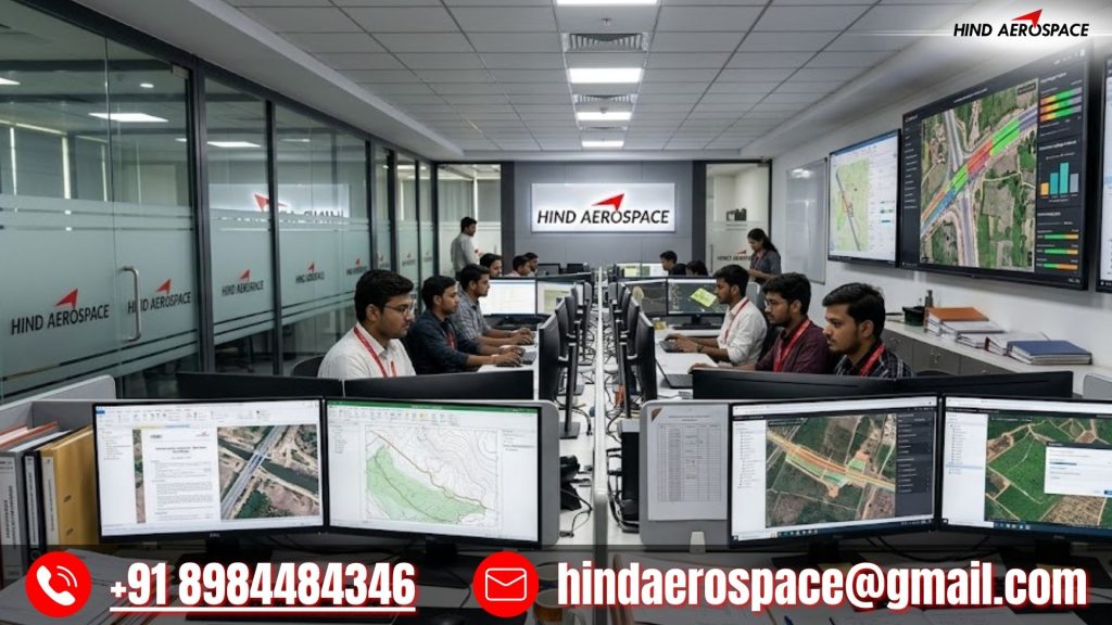
Hind Aerospace offers GIS-based data engineering, LiDAR point cloud processing, georeferenced mapping, multispectral analysis, thermal imaging interpretation, and aerial dataset structuring across Goa. Our geospatial workflows enable accurate land classification, coastal zone studies, infrastructure feasibility analysis, and technical reporting for decision-making support.
Engineering-Grade Drone Analytics for Project Execution
From volumetric survey outputs and shoreline mapping datasets to infrastructure inspection models and project documentation, our drone processing services are designed for engineering precision. Hind Aerospace ensures consistent drone data intelligence in Goa with optimized processing pipelines, reliable outputs, and actionable geospatial insights for modern development needs.