Digital Drone Survey Processing Services in Chhattisgarh
Smart UAV Image Processing for Accurate Mapping Outputs
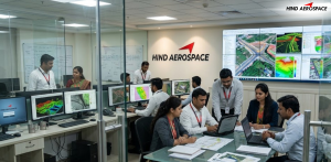
Hind Aerospace delivers digital drone survey processing services in Chhattisgarh for businesses seeking reliable aerial data conversion and precision-based mapping solutions. Our UAV processing workflow transforms raw drone captures into detailed spatial outputs that improve project visualization, field analysis, and survey management across multiple industries.
High-Precision Orthophoto & Elevation Model Generation
We create orthophoto maps, 3D terrain visualizations, contour datasets, DEM, DTM, and DSM outputs using advanced drone photogrammetry techniques. These aerial mapping solutions in Chhattisgarh are highly effective for mining surveys, industrial infrastructure, road development, land assessment, and construction monitoring projects that require accurate topographic information.
Advanced Spatial Data Processing & Remote Sensing Analysis
Hind Aerospace provides spatial data processing, LiDAR interpretation, GIS-integrated mapping, thermal drone analytics, and multispectral image analysis for complex aerial survey applications. Our drone-based data solutions in Chhattisgarh help organizations streamline inspections, improve technical evaluations, and generate accurate geospatial records for operational planning.
Professional Drone Imaging Solutions for Large-Scale Projects
Our UAV imaging services support volumetric calculations, land survey documentation, infrastructure analytics, and project-level geospatial reporting with high accuracy and efficiency. Hind Aerospace ensures scalable drone data processing services in Chhattisgarh that help industries access faster aerial insights and reliable digital mapping results for modern engineering operations.