Drone Data Processing & Geospatial Analytics in Rajasthan
UAV Survey Data Conversion for Digital Mapping Projects
Hind Aerospace provides specialized drone data processing services in Rajasthan for organizations requiring accurate UAV survey outputs and advanced digital mapping solutions. Our aerial data workflows transform raw drone captures into structured datasets that improve project planning, site monitoring, inspection activities, and development operations across multiple industries.
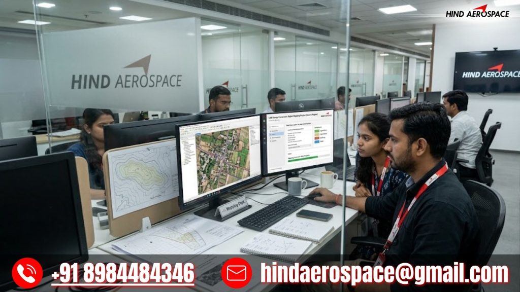
We deliver orthomosaic processing, digital elevation outputs, DTM generation, DSM creation, contour extraction, and 3D surface reconstruction using high-resolution aerial imagery and photogrammetry techniques. These drone mapping applications in Rajasthan support solar projects, industrial zones, transportation corridors, land development, and infrastructure planning where terrain precision is essential.
LiDAR Interpretation, GIS Analytics & Spatial Data Processing
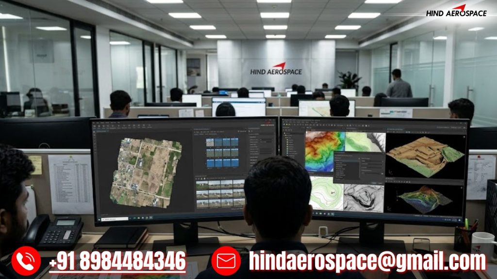
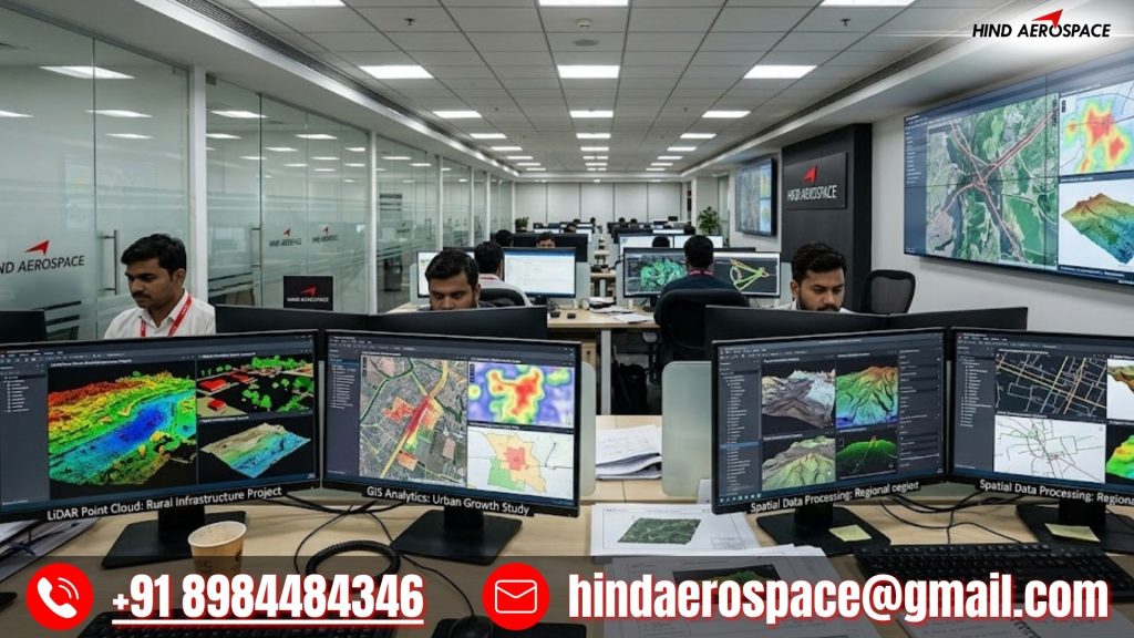
Hind Aerospace offers LiDAR interpretation, GIS analytics, georeferenced mapping, thermal aerial analysis, multispectral processing, and spatial data workflows across Rajasthan. Our drone-based intelligence solutions help businesses improve environmental studies, infrastructure inspections, asset monitoring, and technical evaluations through dependable aerial datasets.
Drone Imaging Intelligence for Engineering & Industrial Operations
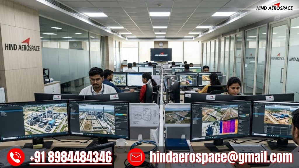
From volumetric measurements and survey visualization outputs to inspection analytics and project-focused geospatial reports, our drone image processing capabilities support modern engineering requirements. Hind Aerospace delivers reliable UAV data processing in Rajasthan with scalable workflows, precise outputs, and actionable aerial insights for faster operational decisions.