Advanced Drone Mapping & Geospatial Data Solutions
Hind Aerospace provides professional drone data processing services in Assam for industries that require accurate aerial mapping and reliable geospatial outputs. Using advanced UAV technology and modern processing software, we convert raw drone imagery into actionable spatial data that supports planning, monitoring, and project execution with greater efficiency.
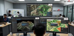
High-Resolution Orthomosaic & 3D Mapping
Our drone data processing in Assam includes orthomosaic map generation, 3D model creation, DEM, DTM, DSM processing, and contour mapping for detailed terrain analysis and land assessment. These high-precision outputs are widely used in infrastructure development, construction projects, mining operations, agriculture, and industrial inspections where accurate mapping is essential.
GIS, LiDAR & Survey Data Processing
Hind Aerospace delivers GIS data processing, georeferenced mapping, LiDAR data analysis, and aerial image processing services across Assam. We help organizations manage complex survey datasets through advanced drone analytics, thermal imaging interpretation, multispectral data processing, and project-based geospatial reporting for improved operational visibility and smarter decision-making.
Reliable UAV Data Processing for Modern Projects
With experienced drone professionals and efficient processing workflows, Hind Aerospace ensures accurate UAV data processing with faster turnaround time and dependable project support. Our drone imagery processing services in Assam help businesses reduce manual effort, improve survey accuracy, and generate reliable aerial intelligence for land surveys, inspections, and development projects.