At Hind Aerospace, we offer professional drone survey services in Chhattisgarh, delivering accurate geospatial data and dependable UAV mapping solutions for government and private sector projects. Our advanced drone surveying services in Chhattisgarh help improve operational efficiency, accelerate project timelines, and provide a smarter alternative to traditional land surveying methods.
By integrating advanced UAV platforms with GIS technology, we capture high-resolution aerial data and convert it into precise maps, 3D terrain models, and analytical reports. These drone mapping services in Chhattisgarh enable businesses to improve planning accuracy, monitor project progress efficiently, and optimize field operations.
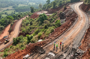
Our UAV survey solutions in Chhattisgarh are widely used across industries such as infrastructure development, agriculture, land management, mining, and construction monitoring, delivering reliable insights and accurate data at every stage of the project.
With a strong focus on precision, compliance, and performance, Hind Aerospace continues to support industrial and infrastructure growth through trusted drone survey and mapping services in Chhattisgarh, helping organizations complete projects faster and more efficiently.
UAV Drone Survey and Aerial Mapping Solutions in Chhattisgarh, delivering high-resolution drone mapping, LiDAR surveying, photogrammetry, and aerial inspection services.
At Hind Aerospace, we deliver advanced UAV drone survey and aerial mapping services in Chhattisgarh, providing precise geospatial intelligence that helps businesses improve planning, increase efficiency, and execute projects with greater accuracy. Our drone mapping solutions in Chhattisgarh are designed to support industries with reliable aerial data, improved site visibility, and smarter operational decisions.
With expertise in LiDAR surveying, high-resolution photogrammetry, and multispectral drone imaging, we capture detailed terrain and surface data for a variety of applications. From mining and infrastructure development to agriculture and environmental monitoring, our UAV survey services in Chhattisgarh provide the accurate information needed for efficient project management.
We also offer aerial inspections, drone videography, and complete drone data processing, transforming aerial imagery into high-value outputs such as orthomosaic maps, 3D terrain models, and GIS-ready datasets. These deliverables help businesses improve workflow efficiency, reduce project delays, and strengthen field coordination.
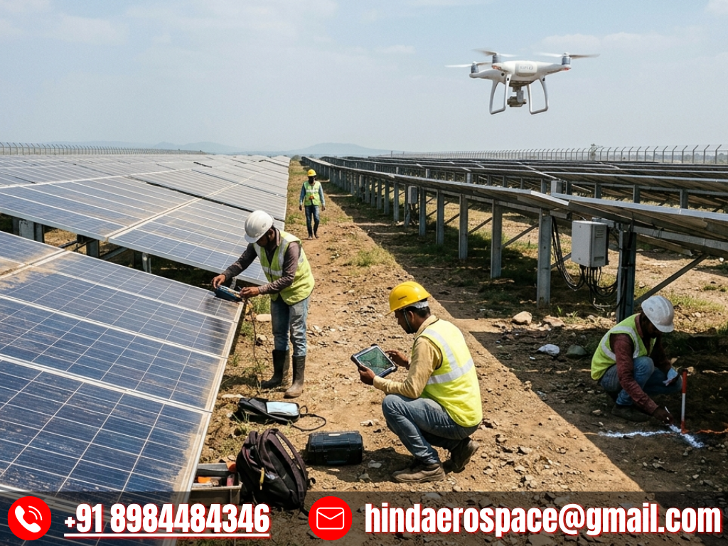
Our solar PV drone inspection services in Chhattisgarh support the energy sector by enabling rapid fault detection, better maintenance planning, and improved system performance.
With a strong commitment to innovation and operational precision, Hind Aerospace provides dependable drone survey and aerial mapping services in Chhattisgarh, helping industries optimize resources, improve productivity, and achieve better project outcomes.
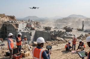
Drone Survey & Mapping Team in Chhattisgarh
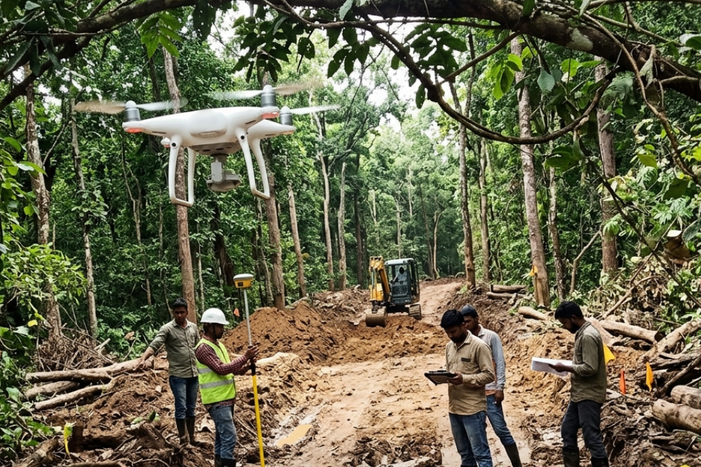
At Hind Aerospace, we provide expert drone survey and mapping services in Chhattisgarh, helping industries gain accurate aerial insights for efficient planning and smooth project execution. Using advanced UAV technology, we deliver reliable geospatial data solutions for drone surveying, aerial mapping, site inspection, and project monitoring across diverse sectors.
Our experienced drone survey and mapping team in Chhattisgarh combines technical expertise with efficient field operations to capture precise aerial data, even in challenging project environments. This enables businesses to improve site visibility, streamline coordination, and make faster, data-driven decisions for infrastructure, construction, agriculture, mining, and land development projects.
With a strong commitment to precision, safety, and operational excellence, Hind Aerospace transforms complex terrain data into actionable insights that improve project performance. Through dependable UAV drone mapping services in Chhattisgarh, we help organizations reduce delays, improve efficiency, and achieve successful project outcomes.
Advanced Drone Survey & Inspection Solutions in Chhattisgarh
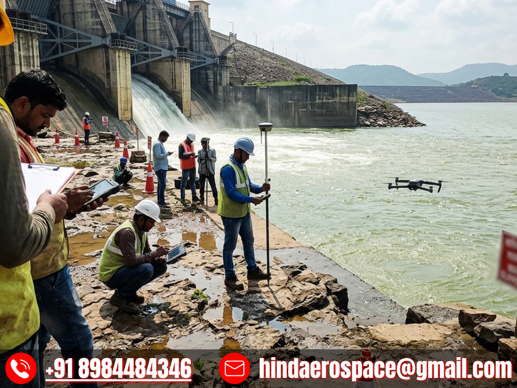
At Hind Aerospace, we provide dependable drone survey and inspection services in Chhattisgarh, helping businesses and project teams obtain accurate aerial insights for efficient planning and seamless project execution. By leveraging advanced UAV technology, we capture reliable geospatial data that improves site monitoring, supports analysis, and enables smarter decision-making across multiple industries.
Our skilled field team manages every phase of the drone operation with precision, ensuring efficient workflows and high-quality aerial data collection. The collected data is processed into actionable insights that improve project visibility, enhance progress tracking, and strengthen operational performance.
With a focus on accuracy, safety, and reliability, Hind Aerospace delivers trusted drone inspection and aerial survey solutions in Chhattisgarh for industries such as infrastructure, agriculture, construction, and industrial development, helping clients complete projects faster and achieve better operational outcomes.