Hind Aerospace delivers professional drone survey services across Arunachal Pradesh, providing precise geospatial data and dependable mapping solutions for both government and private sector projects. Our UAV-driven approach enhances operational efficiency, accelerates project timelines, and minimizes the limitations of traditional surveying methods.
By leveraging advanced drone platforms integrated with GIS technology, we capture high-quality aerial data that is processed into accurate maps, 3D terrain models, and insightful analytical reports. These deliverables enable better planning, effective monitoring, and smoother project execution across multiple sectors.
Our drone survey solutions are extensively applied in infrastructure development, mining, agriculture, land management, and construction monitoring, ensuring reliable data and actionable insights for every stage of the project.
With a strong focus on precision, compliance, and performance, Hind Aerospace supports the growing development needs of Arunachal Pradesh through efficient, technology-driven drone mapping solutions.
UAV Drone Survey and Aerial Mapping Solutions across Arunachal Pradesh, delivering high-resolution mapping, LiDAR surveying, photogrammetry, and inspection services.
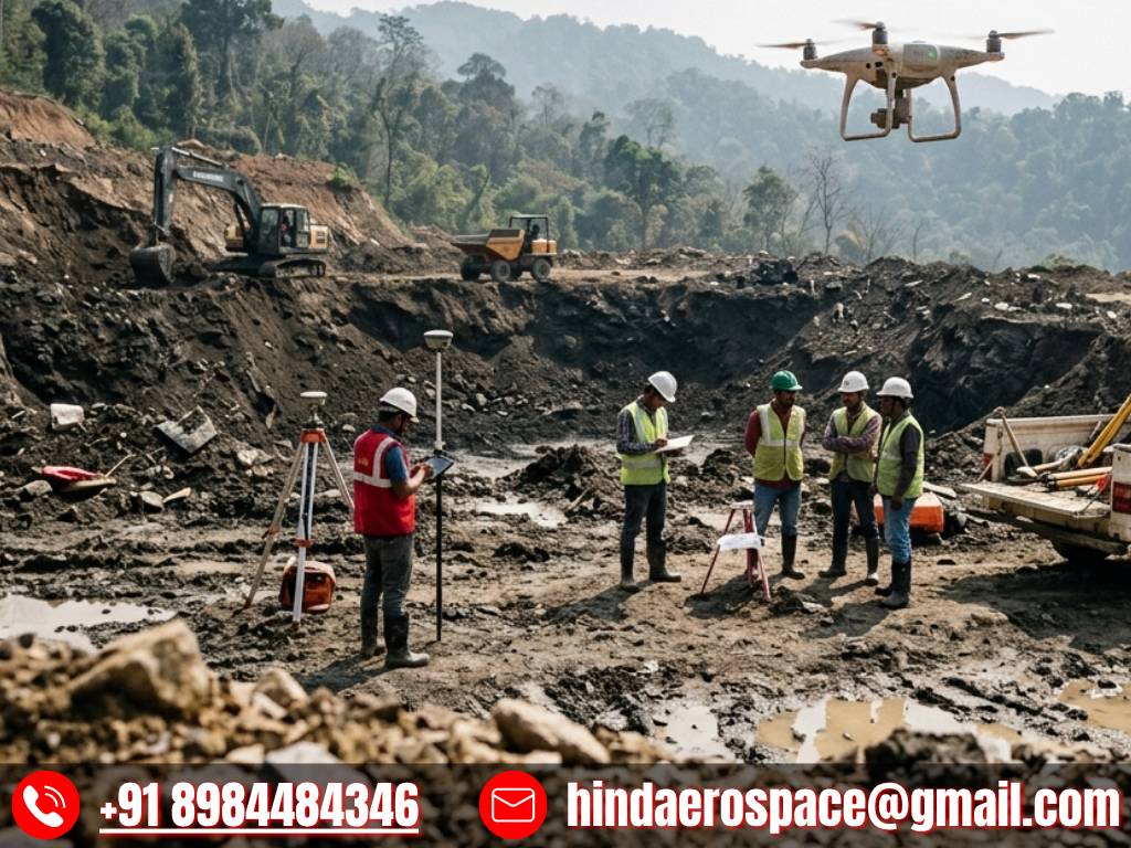
At Hind Aerospace, we offer advanced UAV drone survey and aerial mapping solutions across Arunachal Pradesh, enabling industries to access precise geospatial intelligence for efficient planning and better project management. By integrating advanced drone systems with modern surveying techniques, we help organizations gather accurate aerial data that improves monitoring, streamlines workflows, and supports faster decision-making.
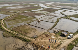
Our capabilities include high-resolution photogrammetry, LiDAR surveys, and multispectral imaging, allowing us to generate accurate terrain information and surface analysis even in challenging landscapes. These solutions are valuable for applications such as infrastructure development, mining operations, agriculture assessment, and environmental monitoring.
In addition to surveying, we provide aerial inspections, drone videography, and comprehensive drone data processing, converting aerial captures into practical outputs like orthomosaic maps, 3D terrain models, and GIS-compatible datasets. These deliverables improve project accuracy and operational efficiency.
We also conduct solar PV inspections using drones, helping identify performance issues, support maintenance planning, and improve the long-term efficiency of solar energy assets.
With a commitment to innovation, safety, and precision-driven operations, Hind Aerospace delivers reliable drone-powered solutions for industries including infrastructure, construction, energy, mining, and agriculture across Arunachal Pradesh, helping clients achieve smarter and more efficient project outcomes.
Drone Survey & Mapping Team in Arunachal Pradesh
At Hind Aerospace, we deliver advanced drone survey and mapping services across Arunachal Pradesh, helping industries obtain accurate aerial intelligence for better planning and efficient project execution. With the use of modern UAV technology, we provide reliable geospatial data solutions for surveying, inspection, and site monitoring applications.
Our experienced field team combines technical knowledge with efficient operational practices to capture precise aerial data, even in challenging terrains. This enables project stakeholders to improve site visibility, optimize workflows, and make quicker, informed decisions across sectors such as infrastructure, construction, agriculture, and land development.
Committed to precision, safety, and operational excellence, Hind Aerospace transforms complex terrain information into practical insights that support productivity and project success. Through dependable drone solutions, we continue to help organizations across Arunachal Pradesh reduce delays, improve efficiency, and achieve better outcomes.
Drone Survey & Inspection Solutions in Arunachal Pradesh
At Hind Aerospace, we provide expert drone survey and inspection services across Arunachal Pradesh, enabling businesses and project teams to gain precise aerial insights for improved planning and smooth execution. With the help of advanced UAV technology, we collect reliable geospatial data that enhances monitoring, analysis, and informed decision-making across multiple industries.
Our skilled field professionals handle each phase of the drone operation with accuracy, ensuring efficient site workflows and high-quality aerial data acquisition. This data is then transformed into meaningful insights that improve project visibility, support progress tracking, and enhance overall operational performance.
With a commitment to precision, safety, and consistent reliability, Hind Aerospace delivers dependable drone-powered solutions for sectors such as infrastructure, agriculture, construction, and industrial development throughout Arunachal Pradesh, helping clients complete projects faster and with greater efficiency.