At Hind Aerospace, we deliver professional drone survey services across Uttar Pradesh, helping industries and government projects achieve accurate mapping and data-driven insights. Our UAV technology enables faster project execution while reducing overall survey costs compared to traditional methods.
With the use of advanced drones and GIS-based tools, we collect high-resolution aerial data and transform it into detailed maps, 3D models, and reliable analytics. Our expertise extends across multiple sectors including land surveying, infrastructure development, mining, agriculture, and construction monitoring.
Focused on precision, speed, and regulatory standards, Hind Aerospace aims to support the growing infrastructure and development needs of Uttar Pradesh through modern and efficient drone solutions.
UAV Drone Survey and Aerial Mapping Solutions across Uttar Pradesh, covering services like high-resolution aerial imaging, advanced photogrammetry mapping, LiDAR-based surveys, multispectral data analysis, drone data processing, detailed site inspections, and solar PV plant monitoring.
Hind Aerospace offers advanced UAV drone survey and aerial mapping services throughout Uttar Pradesh, delivering precise and dependable geospatial solutions tailored to multiple industries. By combining cutting-edge drone systems with modern surveying methodologies, we help organizations collect accurate data for better project planning, real-time monitoring, and informed decision-making.
Our capabilities include high-resolution photogrammetry for detailed terrain mapping and LiDAR-based surveys for capturing accurate elevation and surface data, even in challenging environments. We also provide multispectral imaging services that support agricultural analysis and environmental monitoring, enabling improved crop management and productivity.
In addition, our services cover aerial videography, infrastructure and asset inspection, and comprehensive drone data processing. We transform raw aerial data into actionable outputs such as orthomosaic maps, 3D models, and GIS-compatible datasets that are ready for practical use.
We also specialize in solar PV inspection, helping identify faults, improve system efficiency, and ensure long-term performance through preventive maintenance insights.
With a commitment to innovation, safety standards, and quality delivery, Hind Aerospace provides complete drone-based solutions for sectors like infrastructure, mining, energy, and agriculture across Uttar Pradesh.
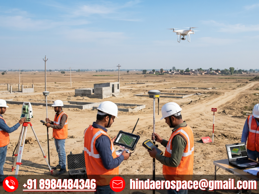
UAV Survey & Mapping Team in Uttar Pradesh
At Hind Aerospace, our experienced drone survey and mapping team operates across Uttar Pradesh, delivering reliable UAV-based solutions for accurate data capture and analysis. We support a wide range of industries by providing efficient aerial surveying, mapping, and inspection services tailored to project-specific requirements.
Our team combines field expertise with advanced drone technology to ensure smooth execution on-site while collecting high-quality geospatial data. This enables better visualization, improved planning, and faster decision-making for projects related to infrastructure, agriculture, construction, and land development.
With a strong focus on precision, safety protocols, and modern tools, we simplify complex terrains into clear, data-driven insights. Hind Aerospace remains committed to helping clients optimize project performance and manage resources effectively across Uttar Pradesh.
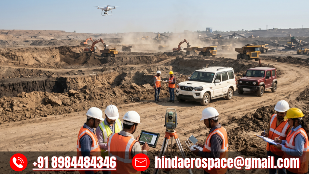
Advanced Drone Survey & Inspection Services in Uttar Pradesh
Hind Aerospace delivers dependable drone survey and inspection services throughout Uttar Pradesh, providing high-precision aerial data for a wide range of projects. By utilizing advanced UAV systems, we help industries capture accurate information for infrastructure development, construction monitoring, agriculture, and industrial applications.
Our team ensures smooth and efficient on-site operations, turning complex aerial data into clear and practical insights. This allows clients to improve planning, monitor progress effectively, and complete projects within shorter timelines.
With a commitment to accuracy, safety standards, and consistent performance, Hind Aerospace provides reliable drone solutions that enable smarter decisions and better project outcomes across Uttar Pradesh.